Recreation
-
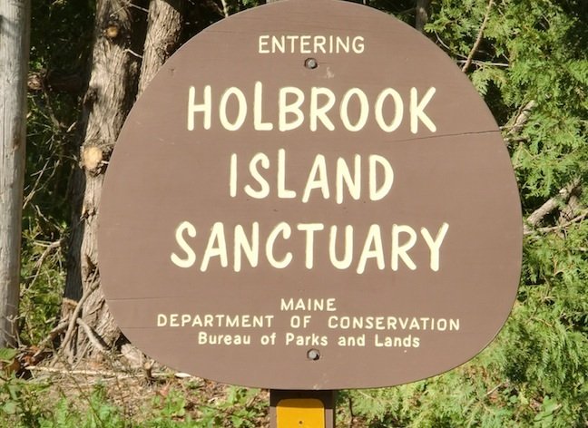
Holbrook Island Sanctuary
172 Indian Bar Rd., P.O. Box 35
Brooksville, ME 04617
326-4012
Open year round. Accessible from the Cape Rosier Rd., Holbrook Island Sanctuary protects many different ecosystems. Picnicing, fishing, hiking trails and watching wildlife.
-

Sedgwick - Brooksville Walker's Pond Public Access
45 Cooper Farm Rd, Sedgwick, Maine 04676
Hours - Dawn to Dusk
No Lifeguard on Duty, swim at your own risk
Inspectors checking for Invasive Species
Boat Launch Available
Picnic Area - Clean up after yourself
Swim floats out by end of June, in by end of September
Fishing floats available
Sand beach and Shallow swim area
Winter time Ice Fishing Access
Pay Attention to ice thickness, use at your own risk
-

Lawrence Family Fitness Center
-

Trails, Parks & Community Resources in the Blue Hill Peninsula Region
(from Healthy Peninsula Blue Hill Peninsula map)
Go to Bottom of Page for Link to Map Itself
TRAILS & OUTDOOR WALKING ROUTES
Listed in alphabetical order
Acadia National Park, Isle au Haut
Numerous trails explore the shores, bogs, and wooded uplands of Isle au Haut.
Route distance: 18 miles total.
Directions: Ferries leave Stonington.
Contact: Acadia National Park, 288-3338,
www.nps.gov/acad/
Barred Island Preserve, Deer Isle
The trail passes through mossy woods to the shore and at low tide over a sandbar to Barred Island. Dogs not permitted.
Route distance: 2 miles roundtrip.
Directions: Take Rte. 15 to Deer Isle. Turn right onto Rte. 15A/Sunset Rd. Turn right onto Goose Cove Rd.
Contact: Island Heritage Trust, 348-2455.
Blue Hill Mountain Trails, Blue Hill
The Osgood and Hayes Trails wind through fields and woods to the summit of Blue Hill Mountain with sweeping views of the bay and village.
Route distance: 2 miles roundtrip.
Directions: In Blue Hill follow Mountain Rd. to a small parking lot at top of hill. Hayes Trail begins across road from parking lot. Osgood Trail leaves Mountain Rd. 1/4 mile west of parking.
Contact: Blue Hill Heritage Trust, 374-5118.
Brooklin Walking and Biking Routes
Several public roads in Brooklin such as High St., Naskeag Rd., Old County Rd., and Dodges Wharf Rd. provide scenic routes for walkers and bicyclists. Public parking available at Town Office, public landings, and the Reggie Sherman Ballfield on Rte. 175.
Carter Nature Preserve, Surry
Paths through the woods and along the shore traverse this 23-acre property.
Route distance: 1.5 miles roundtrip.
For directions and information: Blue Hill Heritage Trust, 374-5118.
Cooper Farm Trail, Sedgwick
This loop trail traverses woods and blueberry fields on scenic Caterpillar Hill.
Route distance: 1 mile. Shorter routes possible using cut-off trails.
For directions and information: Blue Hill Heritage Trust, 374-5118.
Crockett Cove Woods, Stonington
Nature trail passes through a moss-covered spruce forest and a bog with tamaracks. Dogs not permitted.
Directions: Take Rte. 15 to Deer Isle. Turn right onto Rte. 15A/Sunset Rd., and continue about 3 miles beyond the Sunset Post Office. Turn right onto Whitman Rd., then right onto Fire Rd. 88 to trailhead.
Contact: Island Heritage Trust, 348-2455.
Edgar M. Tennis Preserve, Deer Isle
Several trails travel varied terrain, from shore to forest, to a historic cemetery and farm foundations.
Route distance: 3 miles total.
Directions: Take Rte. 15 to Deer Isle. Turn left onto Sunshine Rd. Continue for 2.5 miles. Turn right onto Tennis Rd. and follow it to the preserve.
Contact: Island Heritage Trust, 348-2455.
Ferry Landing Natural Area, Brooksville
Trail winds through woods and old homestead fields to the shore of the Bagaduce River and the site of the historic North Castine-West Brooksville Ferry.
Route distance: 1 mile roundtrip.
Directions: Cross Bagaduce Falls Bridge into Brooksville on Rte. 175/176. Turn right at stop sign. After 3 miles take sharp right onto Ferry Rd. When road splits take right fork (Jones Point Rd.)
Contact: The Conservation Trust of Brooksville, Castine, and Penobscot, 326-9711.
Holbrook Island Sanctuary, Brooksville
Many trails of differing length and difficulty explore shorefront, hills, old homestead fields, and ponds in this publicly owned sanctuary.
Route distance: Varies.
Directions: In Brooksville brown signs on Rte. 176 indicate directions to sanctuary. Trail maps available at park headquarters and trailheads.
Contact: Holbrook Island Sanctuary, 326-4012.
Holt Mill Pond Preserve, Stonington
Trail passes through estuarine and salt marsh habitats.
Directions: Take Rte. 15 into Stonington. Turn right onto Airport Rd. Preserve is just east of Island Medical Center.
Contact: Island Heritage Trust, 348-2455.
Kingdom Woods Conservation Area, Blue Hill
Several loops traverse mixed woodland habitat. Route distance: 3.5 miles total.
For directions and information: Blue Hill Heritage Trust, 374-5118.
Mariners Mile, Deer Isle
A short loop trail with views of fields and shore in Mariners Park. Picnic park and shore access.
Route distance: 0.5 mile loop.
Directions: Take Rte. 15 to Deer Isle. Turn left onto Sunshine Rd. at the Mill Pond Mobil Station. Turn right at Morey Farm Rd. Sign at intersection points to parking and trailhead.
Maude E. and Eugene Snow Natural Area, Brooksville
Two loop trails explore Bagaduce River shorefront and 40 wooded acres.
Route distance: 2.25 miles.
Directions: Cross Bagaduce Falls Bridge into Brooksville on Rte. 175/176. At stop sign turn right onto Rte. 176. Turn right onto Young’s Point Rd. Keep right at fork. Sign on right marks trail.
Contact: The Conservation Trust of Brooksville,
Castine, and Penobscot, 326-9711.
Osgood Trail, Surry
Easily accessible from Surry’s Town Office and Elementary School, this trail loops through town-owned woods behind the athletic field.
Route distance: 1 mile.
Directions: From Rte. 172 in downtown Surry turn onto North Bend Rd. After 1/4 mile turn left into Town Office parking lot. Trail marked with wooden sign behind Town Office.
Contact: Surry Conservation Commission, 667-5912.
Settlement Quarry, Stonington
A network of short trails and old quarry roads that feature information about the local quarrying history and area’s geology.
Route distance: 1.5 miles total.
Directions: Take Rte. 15 to Deer Isle. Continue toward Stonington. At Ron’s Gas Station turn left onto Oceanville Rd. Continue less than 1 mile to marked parking lot on right.
Contact: Island Heritage Trust, 348-2455.
Shore Acres Preserve, Deer Isle
Loop trail passes through a diverse forest and along the shore.
Route distance: 1.5 mile loop.
Directions: Take Rte. 15 to Deer Isle. At Mill Pond Mobil Station turn left onto Sunshine Rd. Go 1.2 miles. Bear left at fork onto Greenlaw District Rd. Continue 0.9 miles to parking area.
Contact: Island Heritage Trust, 348-2455.
-
Parks, Playgrounds & Recreation Fields
Blue Hill
Blue Hill Athletic Fields, Union St.
Blue Hill Consolidated School, High St.
Blue Hill Town Park, Water St.
Horton Emerson Park, Water St.
Brooklin
Reggie Sherman Ballfield, Rte. 175
Brooklin School, Rte. 175
Brooksville
Brooksville Elementary School, Coastal Rd.
Town Recreation Field, Townhouse Rd.
Castine
Adams School, School St.
Backshore Beach and Picnic Area,
Wadsworth Cove Rd.
Dyce’s Head Lighthouse, Battle Ave.
Fort George State Park, Wadsworth Cove Rd.
Fort Madison, Perkins Rd.
Deer Isle
Deer Isle/Stonington Elementary School & High School,
Rte. 15
Mariner’s Park, Morey Farm Rd. off Sunshine Rd.
Penobscot
Penobscot Community School, Rte. 199
Sedgwick
Sedgwick Elementary School, Rte. 15/Snows Cove Rd.
Surry
Carrying Place Beach, Newbury Neck Rd.
Osgood Field, North Bend Rd., behind municipal building.
Surry Elementary School, North Bend Rd.